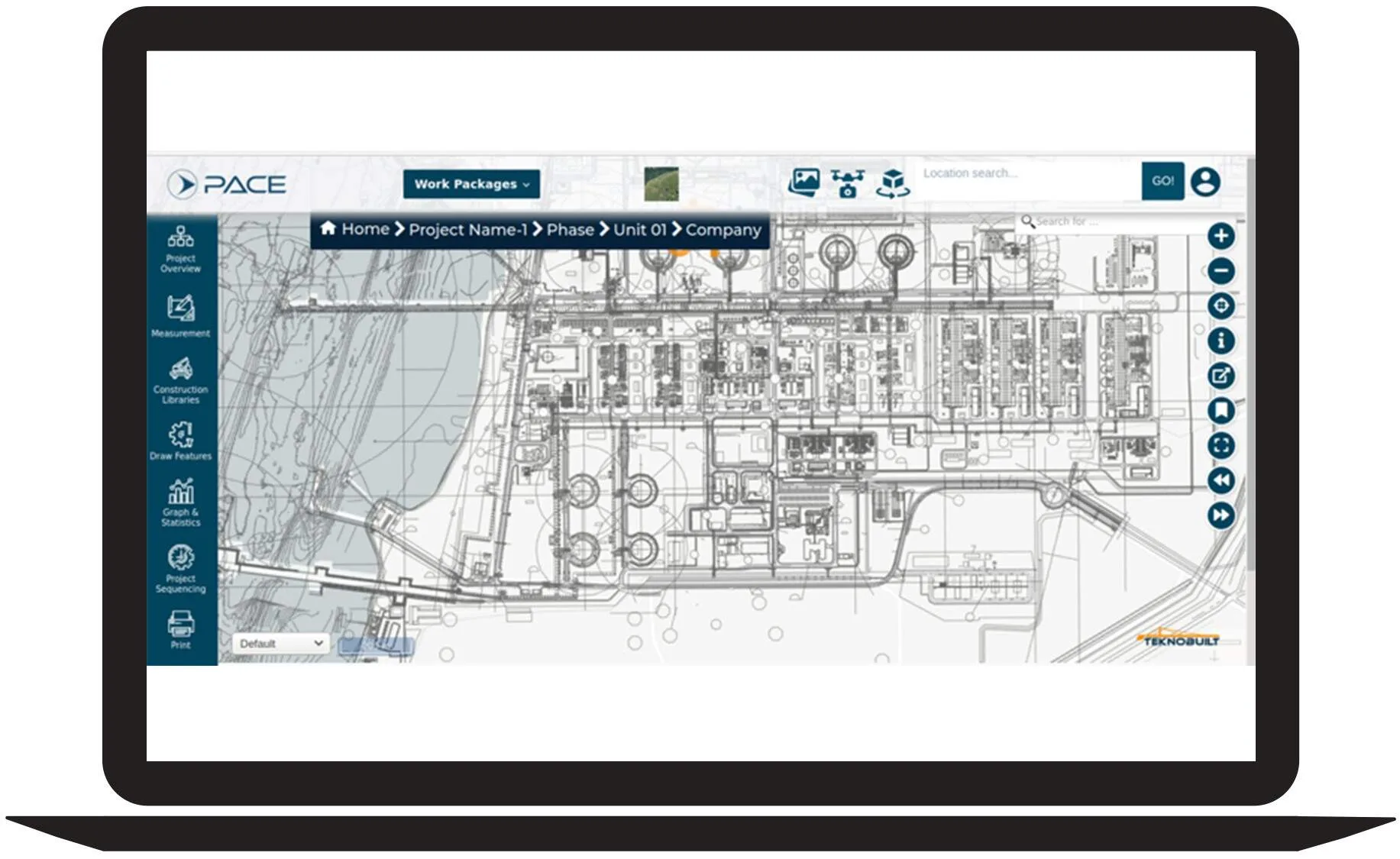
The greatest advantage of Geo Plot Manager is that plot plans are digitally tied to GIS. You can visualize the sequence of construction and corresponding engineering or materials on site. With this module, you can simply create construction area overlays that can be easily modified.
Some of the features of this module are:
- Supports the planning of lay-down areas and movement of material on the site
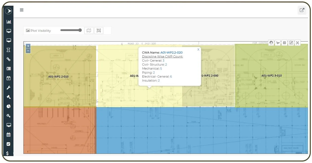
- Real-time visibility of heat maps by function
- Instantaneous view of gaps with drill-down capability to see the details for quick decision making
- A window to your ongoing construction projects
Steps for Geo Plot Manager Module's Process
Link work packages, unit views, construction work packages, Heat maps, and GAP analysis are some of the steps in this module’s processes. Providing the design that must be included in the design process is what Geo Mapping does. Link work packages will be linked to the location in the plot plan. The nature, form, and size of unit views, as well as making payments to contractors, are used to categorize them. The assumptions of the work packages are referred to as construction work packages. A heat map is a visual representation of data that uses color to express values. A gap analysis will be used by a project manager to compare actual and expected performance.
